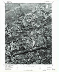
1976 Map of Broadheadsville
USGS Topo · Published 1979About this map
Brodheadsville serves as the focal point for this orthophotoquad, which utilizes imagery from late 1976 to reveal the Monroe County landscape in a transitional state between agricultural heritage and modern residential development. Unlike traditional line-drawn maps, this photo-based survey by the U.S. Geological Survey and the Soil Conservation Service provides a direct visual record of field patterns and woodlots. The layout of Sun Valley in the north and the cluster of dwellings at Effort show the early footprints of community expansion in the region.
Find a feature on this map
5 named features on this map. Tap any name to fly to it.
Don’t see what you’re looking for? This feature index may not catch every label — zoom into the map to look around manually.
Map Details
Editions of this 1976 Broadheadsville Map
This is the sole edition of this map. No revisions or reprints were ever made.
Other maps of this area

1914 · Wind Gap
USGS Topo · 1:62,500

1916 · Wind Gap
USGS Topo · 1:62,500

1919 · Pocono
USGS Topo · 1:62,500

1921 · Pocono
USGS Topo · 1:62,500

1922 · Mauch Chunk
USGS Topo · 1:62,500

1922 · Stoddartsville
USGS Topo · 1:62,500

1923 · Pocono
USGS Topo · 1:62,500

1924 · Stoddartsville
USGS Topo · 1:62,500

1924 · Mauch Chunk
USGS Topo · 1:62,500

1943 · Scranton
USGS Topo · 1:125,000
Featured Places
- Eldred Township, PA
- Brodheadsville, Chestnuthill Township
- Penn Forest Township, PA
- Chestnuthill Township, PA
- Tunkhannock Township, PA