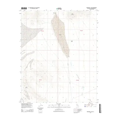
2015 Map of Broadwell Lake
USGS Topo · Published 2015About this map
Broadwell sits at the northern edge of a desert valley defined by the expansive bed of Broadwell Lake. This 2015 topographic study captures the arid character of the Mojave Desert in San Bernardino County, where drainage patterns are dictated by features like Broadwell Wash and Argos Wash. The map documents the high relief of the surrounding landscape, anchored by the Bristol Mountains to the north and the Cady Mountains to the southwest. Sparse infrastructure is represented by Crucero Rd, which cuts through the valley floor. The map's detail provides a clear view of the complex alluvial fans and seasonal watercourses that shape this part of the California desert, offering an essential record for those studying desert topography or regional land use near the Broadwell settlement site.
Find a feature on this map
12 named features on this map. Tap any name to fly to it.
Don’t see what you’re looking for? This feature index may not catch every label — zoom into the map to look around manually.
Map Details
Editions of this 2015 Broadwell Lake Map
This is the sole edition of this map. No revisions or reprints were ever made.
Other maps of this area

1953 · San Bernardino
USGS Topo · 1:250,000

1955 · Ludlow
USGS Topo · 1:24,000

1955 · Ash Hill
USGS Topo · 1:24,000

1955 · Lavic Lake
USGS Topo · 1:24,000

1955 · Lavic
USGS Topo · 1:62,500

1955 · Cady Mountains
USGS Topo · 1:62,500

1955 · Broadwell Lake
USGS Topo · 1:62,500

1955 · Ludlow
USGS Topo · 1:62,500

1956 · San Bernardino
USGS Topo · 1:250,000

1957 · San Bernardino
USGS Topo · 1:250,000