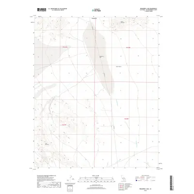
2018 Map of Broadwell Lake
USGS Topo · Published 2018About this map
Broadwell Lake sits at the center of this arid landscape, a prominent dry lake bed characteristic of the high Mojave Desert. The topography is defined by the sharp elevations of the Bristol Mountains to the northeast and the Cady Mountains in the southwest, creating a basin where seasonal runoff travels through Broadwell Wash and Argos Wash. The map documents the minimal human footprint in this section of San Bernardino County, centered on the settlement of Broadwell. Access through this remote corridor is primarily facilitated by Crucero Rd, which traverses the desert floor alongside the ancient lake bed. This survey provides a precise record of the desert's drainage patterns and geological boundaries, reflecting the stark, unpopulated character of the region in the early 21st century.
Find a feature on this map
12 named features on this map. Tap any name to fly to it.
Don’t see what you’re looking for? This feature index may not catch every label — zoom into the map to look around manually.
Map Details
Editions of this 2018 Broadwell Lake Map
This is the sole edition of this map. No revisions or reprints were ever made.
Other maps of this area

1953 · San Bernardino
USGS Topo · 1:250,000

1955 · Ludlow
USGS Topo · 1:24,000

1955 · Ash Hill
USGS Topo · 1:24,000

1955 · Lavic Lake
USGS Topo · 1:24,000

1955 · Lavic
USGS Topo · 1:62,500

1955 · Cady Mountains
USGS Topo · 1:62,500

1955 · Broadwell Lake
USGS Topo · 1:62,500

1955 · Ludlow
USGS Topo · 1:62,500

1956 · San Bernardino
USGS Topo · 1:250,000

1957 · San Bernardino
USGS Topo · 1:250,000