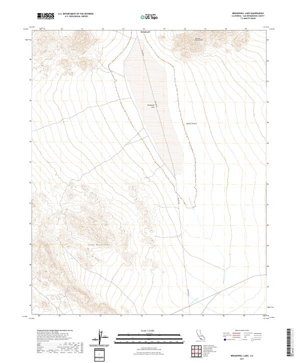
2021 Map of Broadwell Lake
USGS Topo · Published 2021About this map
Broadwell Lake occupies a central depression within this arid stretch of the Mojave Desert, surrounded by the elevations of the Bristol Mountains to the north and the Cady Mountains to the southwest. This area of San Bernardino County reflects the stark hydrology of the high desert, where drainage patterns like Broadwell Wash and Argos Wash define the movement of seasonal runoff toward the lake bed. Historically, the namesake Broadwell location and the winding path of Cruciero Rd represent the thin human footprint in a landscape dominated by township and range surveying lines. The map reveals the relationship between these mountain ranges and the dry lake basin, illustrating how natural topographic boundaries dictated the primitive road networks and the sparse settlement patterns of this desert interior.
Find a feature on this map
12 named features on this map. Tap any name to fly to it.
Don’t see what you’re looking for? This feature index may not catch every label — zoom into the map to look around manually.
Map Details
Editions of this 2021 Broadwell Lake Map
This is the sole edition of this map. No revisions or reprints were ever made.
Other maps of this area

1953 · San Bernardino
USGS Topo · 1:250,000

1955 · Ludlow
USGS Topo · 1:24,000

1955 · Ash Hill
USGS Topo · 1:24,000

1955 · Lavic Lake
USGS Topo · 1:24,000

1955 · Lavic
USGS Topo · 1:62,500

1955 · Cady Mountains
USGS Topo · 1:62,500

1955 · Broadwell Lake
USGS Topo · 1:62,500

1955 · Ludlow
USGS Topo · 1:62,500

1956 · San Bernardino
USGS Topo · 1:250,000

1957 · San Bernardino
USGS Topo · 1:250,000