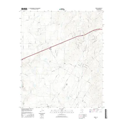
2016 Map of Brock
USGS Topo · Published 2016About this map
Brock and Brock Junction serve as the primary hubs in this Parker County landscape, where the rolling terrain of North Central Texas is defined by the winding course of the Brazos River. This 2016 survey illustrates a community deeply rooted in its local history, evidenced by a high density of small family or community burial grounds including Brashears Cem, Fairview Cem, and Hiner Cem. The map reveals how modern infrastructure, such as the major thoroughfare of Wolf Hollow, intersects with older geographic landmarks like Hicks Bluff and Stephens Bluff along the river's edge. Tributaries like Grindstone Cr and Patrick Cr drain the surrounding ranch land, while local aviation is represented by private facilities such as Eagle Airport and the Tailspin Estates Airport, showing a transition from traditional agricultural use to residential estates and small-scale private utility.
Find a feature on this map
93 named features on this map. Tap any name to fly to it.
Don’t see what you’re looking for? This feature index may not catch every label — zoom into the map to look around manually.
Map Details
Editions of this 2016 Brock Map
This is the sole edition of this map. No revisions or reprints were ever made.
Other maps of this area

1891 · Weatherford
USGS Topo · 1:125,000

1891 · Palo Pinto
USGS Topo · 1:125,000

1893 · Weatherford
USGS Topo · 1:125,000

1918 · Palo Pinto
USGS Topo · 1:125,000

1924 · Weatherford 3-d
USGS Topo · 1:48,000

1927 · Mineral Wells
USGS Topo · 1:62,500

1931 · Dennis
USGS Topo · 1:62,500

1931 · Santo
USGS Topo · 1:62,500

1954 · Dallas
USGS Topo · 1:250,000

1954 · Abilene
USGS Topo · 1:250,000