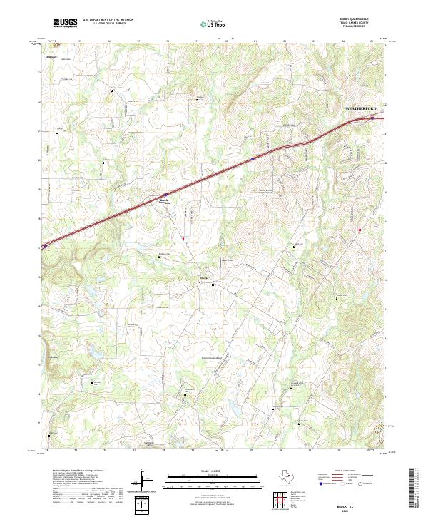
2022 Map of Brock
USGS Topo · Published 2022About this map
Brock and Brock Junction sit at the heart of this Parker County landscape, where the terrain transitions toward the Brazos River at the southwestern corner of the quadrangle. The river’s path is marked by prominent natural landmarks like Hicks Bluff and Stephens Bluff, creating a distinct vertical relief against the surrounding creek systems. The drainage network is dense, defined by the winding paths of Grindstone Cr, Little Grindstone Cr, and Salt Br.
Find a feature on this map
106 named features on this map. Tap any name to fly to it.
Don’t see what you’re looking for? This feature index may not catch every label — zoom into the map to look around manually.
Map Details
Editions of this 2022 Brock Map
This is the sole edition of this map. No revisions or reprints were ever made.
Other maps of this area

1891 · Weatherford
USGS Topo · 1:125,000

1891 · Palo Pinto
USGS Topo · 1:125,000

1893 · Weatherford
USGS Topo · 1:125,000

1918 · Palo Pinto
USGS Topo · 1:125,000

1924 · Weatherford 3-d
USGS Topo · 1:48,000

1927 · Mineral Wells
USGS Topo · 1:62,500

1931 · Dennis
USGS Topo · 1:62,500

1931 · Santo
USGS Topo · 1:62,500

1954 · Dallas
USGS Topo · 1:250,000

1954 · Abilene
USGS Topo · 1:250,000