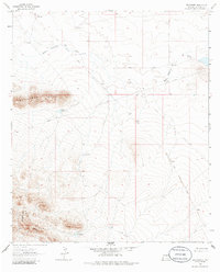
1964 Map of Brockman
USGS Topo · Published 1986About this map
The Continental Divide winds through the southwestern corner of this high-desert landscape, crossing the crest of the Coyote Hills. The mapping reveals a sparse ranching and industrial infrastructure defined by water sources and transportation routes. Several namesake wells and tanks, such as Brockman Well, Warren West Well, and Coyote Tank, serve as vital landmarks for local history and land management.
Find a feature on this map
17 named features on this map. Tap any name to fly to it.
Don’t see what you’re looking for? This feature index may not catch every label — zoom into the map to look around manually.
Map Details
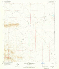
Editions of this 1964 Brockman Map
2 editions found
Other maps of this area

1918 · Hachita
USGS Topo · 1:62,500

1918 · Playas
USGS Topo · 1:62,500

1919 · Playas
USGS Topo · 1:62,500

1954 · Silver City
USGS Topo · 1:250,000

1955 · Douglas
USGS Topo · 1:250,000

1958 · Silver City
USGS Topo · 1:250,000

1959 · Douglas
USGS Topo · 1:250,000

1961 · Douglas
USGS Topo · 1:250,000

1962 · Silver City
USGS Topo · 1:250,000

1964 · Douglas
USGS Topo · 1:250,000