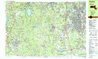
1987 Map of Brockton
USGS Topo · Published 1987About this map
Borderland State Park and the sprawling wetlands of the Hockomock Swamp Wildlife Management Area anchor the landscape between the burgeoning suburban centers of Brockton and Mansfield. This 1987 survey details a region defined by its transition from industrial roots to a dense educational and medical corridor, featuring Stonehill College and the VA Hospital. The mapping of small hamlets like Furnace Village and crossroads such as Daley Corner alongside modern infrastructure like Mansfield Municipal Airport illustrates the layer-by-layer growth of eastern Massachusetts. Genealogists will find a high density of local landmarks, including St Marys Cem and Washington Cem, which serve as quiet anchors for established neighborhoods. The network of water bodies, from Massapoag Lake in Sharon to Upper Leach Pond, highlights the region's managed water resources and recreational spaces that persist amidst suburban expansion.
Find a feature on this map
151 named features on this map. Tap any name to fly to it.
Don’t see what you’re looking for? This feature index may not catch every label — zoom into the map to look around manually.
Map Details
Editions of this 1987 Brockton Map
2 editions found
Other maps of this area

1885 · Abington
USGS Topo · 1:62,500

1885 · Middleboro
USGS Topo · 1:62,500

1885 · Taunton
USGS Topo · 1:62,500

1886 · Dedham
USGS Topo · 1:62,500

1887 · Franklin
USGS Topo · 1:62,500

1887 · Providence
USGS Topo · 1:62,500

1888 · Taunton
USGS Topo · 1:62,500

1888 · Middleboro
USGS Topo · 1:62,500

1888 · Abington
USGS Topo · 1:62,500

1889 · Providence
USGS Topo · 1:62,500