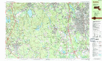
1987 Map of Brockton
USGS Topo · Published 1987About this map
Massapoag Lake and the rugged heights of Moose Hill anchor the northern landscape of this late-1980s study, which traces the transition from the dense urban grid of Brockton to the wooded preserves of Borderland State Park. The map documents a complex network of local settlements and crossroads, including Furnace Village and Ginty Corner, alongside the institutional infrastructure of the VA Hospital and Cardinal Cushing Hospital.
Find a feature on this map
142 named features on this map. Tap any name to fly to it.
Don’t see what you’re looking for? This feature index may not catch every label — zoom into the map to look around manually.
Map Details
Editions of this 1987 Brockton Map
2 editions found
Other maps of this area

1885 · Abington
USGS Topo · 1:62,500

1885 · Middleboro
USGS Topo · 1:62,500

1885 · Taunton
USGS Topo · 1:62,500

1886 · Dedham
USGS Topo · 1:62,500

1887 · Franklin
USGS Topo · 1:62,500

1887 · Providence
USGS Topo · 1:62,500

1888 · Taunton
USGS Topo · 1:62,500

1888 · Middleboro
USGS Topo · 1:62,500

1888 · Abington
USGS Topo · 1:62,500

1889 · Providence
USGS Topo · 1:62,500