Loading...
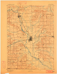
Loading map...1893 Map of Brodhead
USGS Topo · Published 1902About this map
Brodhead serves as the central hub of this late 19th-century landscape, where the Chicago Milwaukee and Saint Paul Railroad forms a critical junction. The rail lines intersect near the heart of the town, connecting the community to larger markets while smaller settlements like Decatur and Magnolia Station mark the rural periphery. The Sugar River and its tributary, the Little Sugar River, meander through the terrain, defining the boundaries of townships like Albany and Spring Valley.
Find a feature on this map
28 named features on this map. Tap any name to fly to it.
Don’t see what you’re looking for? This feature index may not catch every label — zoom into the map to look around manually.
Map Details
Date Portrayed1893
Date Published1902
PublisherU.S. Geological Survey
Map TypeTopographic
Scale1:62,500
Physical Dimensions15.8 x 20.3 inches
Editions of this 1893 Brodhead Map
5 editions found

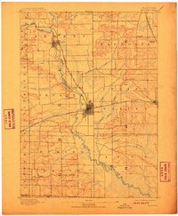
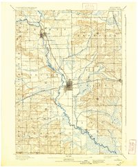
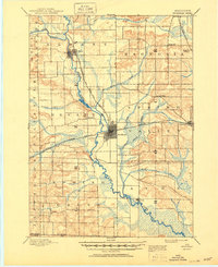
Historical Maps of Brodhead Through Time

Featured Locations
Source Details
SourceU.S. Geological Survey
CopyrightPublic Domain