Loading...
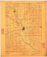
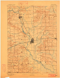
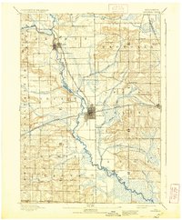
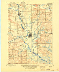
Loading map...1893 Map of Brodhead
USGS Topo · Published 1910About this map
Brodhead serves as the central hub for this corner of Green and Rock counties, where the Chicago Milwaukee and Saint Paul Railroad forms a critical junction. The rail lines bisect the landscape, connecting the main settlement with outlying stops like Magnolia Station and the village of Albany to the north. This network facilitated the movement of goods and people through a region defined by its waterway systems, most notably the winding course of the Sugar River and the Little Sugar River.
Find a feature on this map
29 named features on this map. Tap any name to fly to it.
Don’t see what you’re looking for? This feature index may not catch every label — zoom into the map to look around manually.
Map Details
Date Portrayed1893
Date Published1910
PublisherU.S. Geological Survey
Map TypeTopographic
Scale1:62,500
Physical Dimensions16.78 x 20.38 inches
Editions of this 1893 Brodhead Map
5 editions found

Historical Maps of Brodhead Through Time

Featured Locations
Source Details
SourceU.S. Geological Survey
CopyrightPublic Domain