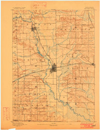
1893 Map of Brodhead
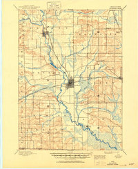
USGS Topo · Published 1950About this map
The Sugar River and its major tributary, the Little Sugar River, define the character of the Southern Wisconsin landscape on this late 19th-century survey. The terrain is marked by a complex network of marshes and winding creeks, including Norwegian Creek and the expansive Taylor Marsh east of Brodhead. The settlement pattern follows the geography of the Chicago Milwaukee and Saint Paul Railroad, which links the regional hubs of Albany and Brodhead to smaller stops like Magnolia Station. This survey provides a look at the area before modern infrastructure, showing the high density of small rural communities like Oakley, Pedee, and Tyrone near the Wisconsin Illinois Boundary Line. For genealogists and local historians, the map preserves the exact street grids and rail alignments of these towns during a period of agricultural and industrial expansion.
Find a feature on this map
29 named features on this map. Tap any name to fly to it.
Don’t see what you’re looking for? This feature index may not catch every label — zoom into the map to look around manually.
Map Details
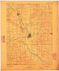
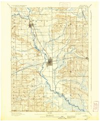
Editions of this 1893 Brodhead Map
5 editions found