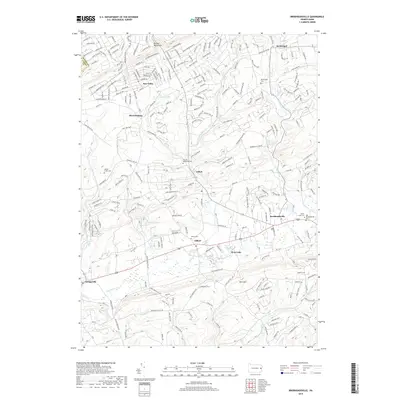
2019 Map of Brodheadsville
USGS Topo · Published 2019About this map
The southern slopes of the Pocono Mountains converge here at the headwaters of Pohopoco Cr, where early ridge-and-valley settlements like Effort, Gilbert, and Brodheadsville established themselves along the winding corridors of Monroe County. The landscape is defined by the prominent Weir Mtn to the south and a network of water bodies including Lake Mineola, Seneca Lake, and Hemlock Lake. For family historians, the map is particularly detailed in its marking of local burial sites, from the centrally located Hillside Memorial Cem to the Old Brodheadsville Cem and Buena Vista Cem near the town center. The settlement pattern shows a shift from traditional creek-side villages to modern residential developments like Sun Valley, illustrating the area's continued evolution as a residential and recreational gateway in the Poconos.
Find a feature on this map
238 named features on this map. Tap any name to fly to it.
Don’t see what you’re looking for? This feature index may not catch every label — zoom into the map to look around manually.
Map Details
Editions of this 2019 Brodheadsville Map
This is the sole edition of this map. No revisions or reprints were ever made.
Other maps of this area

1914 · Wind Gap
USGS Topo · 1:62,500

1916 · Wind Gap
USGS Topo · 1:62,500

1919 · Pocono
USGS Topo · 1:62,500

1921 · Pocono
USGS Topo · 1:62,500

1922 · Mauch Chunk
USGS Topo · 1:62,500

1922 · Stoddartsville
USGS Topo · 1:62,500

1923 · Pocono
USGS Topo · 1:62,500

1924 · Stoddartsville
USGS Topo · 1:62,500

1924 · Mauch Chunk
USGS Topo · 1:62,500

1943 · Scranton
USGS Topo · 1:125,000
Featured Places
- Brodheadsville, Chestnuthill Township
- Indian Mountain Lake, PA
- Penn Forest Township, PA
- Sierra View, PA
- Jackson Township, PA