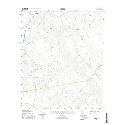
2017 Map of Brogdon
USGS Topo · Published 2017About this map
Pocataligo River and its intricate network of tributaries, including Briar Br and Guckolds Br, define the landscape of this region south of the county seat. The map reveals a transition from the developing fringes of South Sumter and Pocalla Springs in the north to the more dispersed agricultural communities of Brogdon and Privateer. Family and local history are preserved in the locations of Bradford Cem and Marshall Cem, while the presence of named water bodies like Des Champs Pond and Idle Wild Pond indicates a landscape shaped by both natural drainage and managed water resources. A complex road system, featuring routes like Britton Brogdon Rd and Old Georgetown Rd, connects these rural outposts, crossing the county line into Clarendon County near the southern reaches of Sammy Swamp.
Find a feature on this map
110 named features on this map. Tap any name to fly to it.
Don’t see what you’re looking for? This feature index may not catch every label — zoom into the map to look around manually.
Map Details
Editions of this 2017 Brogdon Map
This is the sole edition of this map. No revisions or reprints were ever made.
Other maps of this area

1920 · Mayesville
USGS Topo · 1:48,000

1920 · Manning
USGS Topo · 1:48,000

1921 · Manning
USGS Topo · 1:62,500

1921 · Mayesville
USGS Topo · 1:62,500

1943 · Mayesville
USGS Topo · 1:62,500

1944 · Manning
USGS Topo · 1:62,500

1946 · Sumter
USGS Topo · 1:62,500

1954 · Augusta
USGS Topo · 1:250,000

1957 · Sumter East
USGS Topo · 1:24,000

1957 · Sumter West
USGS Topo · 1:24,000