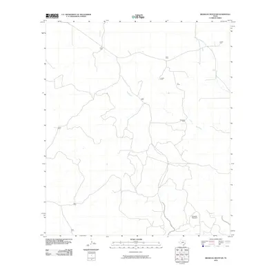
2010 Map of Brokeleg Mountain
USGS Topo · Published 2010About this map
Brokeleg Mountain anchor’s this portion of the Texas Edwards Plateau, where the landscape is defined by the traditional ranching economy of Sutton County. This 2010 survey highlights a network of family-named ranching estates, including the Schwiening Ranch, Luckie Ranch, and Sykes Ranch, which are connected by a web of rural roads and tracks. The hydrology of the region is centered on seasonal drainage systems such as Epps Creek and West Copperas Creek, while Pecan Springs suggests a vital water source in this semi-arid environment. The distribution of these ranch headquarters, such as the Jacoby Ranch and Kelley Ranch, illustrates the enduring land-use patterns of large-scale livestock operations that have shaped this part of West Texas for generations.
Find a feature on this map
14 named features on this map. Tap any name to fly to it.
Don’t see what you’re looking for? This feature index may not catch every label — zoom into the map to look around manually.
Map Details
Editions of this 2010 Brokeleg Mountain Map
This is the sole edition of this map. No revisions or reprints were ever made.
Other maps of this area

1893 · Rock Springs
USGS Topo · 1:125,000

1893 · Fort McKavett
USGS Topo · 1:125,000

1954 · Sonora
USGS Topo · 1:250,000

1958 · Sonora
USGS Topo · 1:250,000

1962 · Roosevelt
USGS Topo · 1:24,000

1963 · Buffalo Well
USGS Topo · 1:24,000

1963 · Live Oak Draw
USGS Topo · 1:24,000

1963 · McKegan Draw
USGS Topo · 1:24,000

1963 · Buffalo Well SE
USGS Topo · 1:24,000
1963 · Fort Terrett Ranch
USGS Topo · 1:24,000