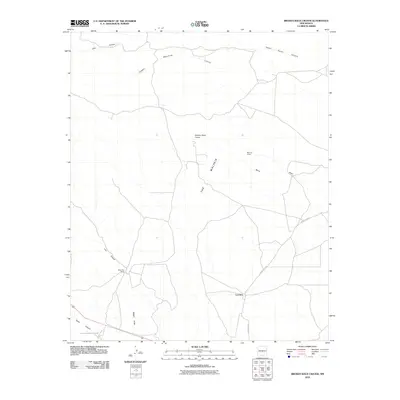
2010 Map of Broken Back Crater
USGS Topo · Published 2010About this map
Broken Back Crater dominates the central landscape of this Lincoln County survey, providing a clear view of the geologic transition into the dark basalt flows of The Malpais. The map documents a sparse, high-desert environment defined by rugged drainage systems like Lobo Canyon and Hidden Waterhole Canyon. Industrial history is represented by the Mex-Tex Group mining interest in the northeast, while the southwestern corner of the quadrangle is occupied by the restricted territory of the White Sands Missile Range. Small settlements and outposts such as Lovelace and Black Hills Ranch are connected by a network of primitive roads and County Rd A012, reflecting the ranching and resource extraction economy of the region. The map captures the alignment of drainages like Serno Draw and Walker Draw as they navigate the volcanic terrain.
Find a feature on this map
14 named features on this map. Tap any name to fly to it.
Don’t see what you’re looking for? This feature index may not catch every label — zoom into the map to look around manually.
Map Details
Editions of this 2010 Broken Back Crater Map
This is the sole edition of this map. No revisions or reprints were ever made.
Other maps of this area

1918 · Oscura Peak
USGS Topo · 1:125,000

1938 · Carrizozo
USGS Topo · 1:48,000

1943 · Carrizozo
USGS Topo · 1:62,500

1948 · Broken Back Crater
USGS Topo · 1:62,500

1948 · Chihuahua Ranch
USGS Topo · 1:62,500

1950 · Carrizozo
USGS Topo · 1:62,500

1950 · Little Black Peak
USGS Topo · 1:62,500

1954 · Tularosa
USGS Topo · 1:250,000

1955 · Roswell
USGS Topo · 1:250,000

1958 · Roswell
USGS Topo · 1:250,000