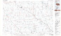
1985 Map of Broken Bow
USGS Topo · Published 1985About this map
Broken Bow serves as the central hub of this mid-1980s Nebraska landscape, where the Burlington Northern railroad corridor dictates the placement of towns like Berwyn, Ansley, and Mason City (Mason Sta). The terrain is defined by broad plateaus and deep drainage systems, including the West Table and Ryno Table, which are dissected by the winding courses of the Middle Loup River and South Loup River. This topographical arrangement highlights the challenges of early prairie transportation, as rail lines followed the path of least resistance along Mud Creek while settlements clustered near vital water sources.
Find a feature on this map
77 named features on this map. Tap any name to fly to it.
Don’t see what you’re looking for? This feature index may not catch every label — zoom into the map to look around manually.
Map Details
Editions of this 1985 Broken Bow Map
2 editions found
Other maps of this area

1896 · Lexington
USGS Topo · 1:125,000

1896 · Kearney
USGS Topo · 1:125,000

1896 · Wood River
USGS Topo · 1:125,000

1899 · Lexington
USGS Topo · 1:125,000

1899 · Loup
USGS Topo · 1:125,000

1902 · Gothenburg
USGS Topo · 1:125,000

1948 · Linscott
USGS Topo · 1:62,500

1950 · Linscott
USGS Topo · 1:62,500

1951 · Broken Bow NE
USGS Topo · 1:24,000

1951 · Westerville
USGS Topo · 1:24,000