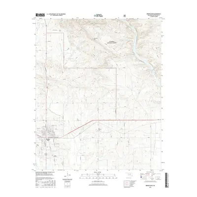
2016 Map of Broken Bow
USGS Topo · Published 2016About this map
Broken Bow serves as the primary hub of this McCurtain County landscape, where the town's grid expands toward the Broken Bow City Lake and numerous local landmarks. The area is defined by a complex network of waterways, including Mountain Fork, Yanubbee Cr, and Crooked Cr, which drain the timbered elevations of the Ouachita National Forest. Local history and genealogy are anchored by several sites, including the Broken Bow Cem, Oka Achukma Cem, and Crown Hill Cem. North of the main settlement, the terrain rises toward Horseshoe Mtn and the community of Hochtown, illustrating the transition from the structured residential blocks of E Dr Martin Luther King Dr to the more dispersed patterns of the northern hills. The presence of Presbyterian Falls on the Mountain Fork further emphasizes the significance of the river system to the regional character.
Find a feature on this map
42 named features on this map. Tap any name to fly to it.
Don’t see what you’re looking for? This feature index may not catch every label — zoom into the map to look around manually.
Map Details
Editions of this 2016 Broken Bow Map
This is the sole edition of this map. No revisions or reprints were ever made.
Other maps of this area

1902 · Lukfata
USGS Topo · 1:125,000

1950 · Mcalester
USGS Topo · 1:250,000

1950 · Idabel
USGS Topo · 1:24,000

1950 · Shults
USGS Topo · 1:24,000

1950 · Goodwater
USGS Topo · 1:24,000

1951 · Idabel
USGS Topo · 1:24,000

1951 · Shults
USGS Topo · 1:24,000

1951 · Goodwater
USGS Topo · 1:24,000

1953 · Texarkana
USGS Topo · 1:250,000

1956 · Texarkana
USGS Topo · 1:250,000