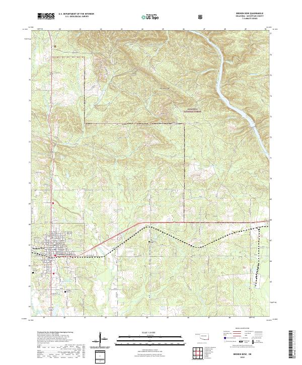
2022 Map of Broken Bow
USGS Topo · Published 2022About this map
Broken Bow serves as the focal point for this McCurtain County survey, situated where the rolling forest edge meets structured township growth. The town grid is clearly defined, with streets like E Dr Martin Luther King Dr and W Wade St anchoring the community south of the newer bypass. To the north and east, the landscape transitions into the Ouachita National Forest, a terrain characterized by ridges like Horseshoe Mtn and the winding course of the Mountain Fork river. Local history is preserved through scattered burial grounds, including Crown Hill Cem and Oka Achukma Cem, reflecting the area's deep roots. The hydrography is particularly complex, with the Middle Fork Yanubbee Cr and E Fork Yanubbee Cr feeding into the Broken Bow City Lake, illustrating the intersection of natural water systems and modern infrastructure.
Find a feature on this map
53 named features on this map. Tap any name to fly to it.
Don’t see what you’re looking for? This feature index may not catch every label — zoom into the map to look around manually.
Map Details
Editions of this 2022 Broken Bow Map
This is the sole edition of this map. No revisions or reprints were ever made.
Other maps of this area

1902 · Lukfata
USGS Topo · 1:125,000

1950 · Mcalester
USGS Topo · 1:250,000

1950 · Idabel
USGS Topo · 1:24,000

1950 · Shults
USGS Topo · 1:24,000

1950 · Goodwater
USGS Topo · 1:24,000

1951 · Idabel
USGS Topo · 1:24,000

1951 · Shults
USGS Topo · 1:24,000

1951 · Goodwater
USGS Topo · 1:24,000

1953 · Texarkana
USGS Topo · 1:250,000

1956 · Texarkana
USGS Topo · 1:250,000