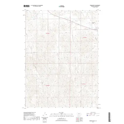
2017 Map of Broken Bow SE
USGS Topo · Published 2017About this map
Berwyn anchors the northeastern corner of this Custer County landscape, situated where the terrain transitions into the distinct geographic feature of Dutchman Valley. The drainage patterns of the region are defined by the meandering course of Mud Cr and Deer Cr, which carve through the undulating topography typical of central Nebraska's loess hills. In the northwest, Carothers Lake provides a notable water landmark amidst a grid of rural section roads like Sumner Rd and Berwyn Rd. The map illustrates the persistent structure of the Public Land Survey System, with township and range lines like t16n r19w dividing the open country into a disciplined network of agricultural holdings and remote transport corridors.
Find a feature on this map
25 named features on this map. Tap any name to fly to it.
Don’t see what you’re looking for? This feature index may not catch every label — zoom into the map to look around manually.
Map Details
Editions of this 2017 Broken Bow SE Map
This is the sole edition of this map. No revisions or reprints were ever made.
Other maps of this area

1951 · Broken Bow NE
USGS Topo · 1:24,000

1951 · Westerville
USGS Topo · 1:24,000

1951 · Broken Bow SW
USGS Topo · 1:24,000

1951 · Ansley
USGS Topo · 1:24,000

1951 · Broken Bow
USGS Topo · 1:24,000

1951 · Broken Bow SE
USGS Topo · 1:24,000

1951 · Eddyville NE
USGS Topo · 1:24,000

1951 · Eddyville NW
USGS Topo · 1:24,000

1951 · Mason City NW
USGS Topo · 1:24,000

1955 · Broken Bow
USGS Topo · 1:250,000