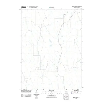
2011 Map of Broken Bow SW
USGS Topo · Published 2011About this map
Ash Creek meanders through this portion of Custer County, shaping the drainage patterns and valley structure of the Nebraska landscape. This 2011 survey reveals a region defined by agricultural field patterns and a sparse network of section-line roads, illustrating the modern rural layout of the Great Plains. The prominent course of Ash Creek serves as the primary geographic anchor for the quadrangle, with its intermittent flow paths reflecting the semi-arid hydrology of the region. Most of the map area is characterized by open terrain and small impoundments, typical of the land management and cattle-ranching operations that dominate this part of the state.
Find a feature on this map
1 named feature on this map. Tap any name to fly to it.
Don’t see what you’re looking for? This feature index may not catch every label — zoom into the map to look around manually.
Map Details
Editions of this 2011 Broken Bow SW Map
This is the sole edition of this map. No revisions or reprints were ever made.
Other maps of this area

1951 · Broken Bow NE
USGS Topo · 1:24,000

1951 · Broken Bow SW
USGS Topo · 1:24,000

1951 · Broken Bow
USGS Topo · 1:24,000

1951 · Broken Bow SE
USGS Topo · 1:24,000

1951 · Merna
USGS Topo · 1:24,000

1951 · Eddyville NE
USGS Topo · 1:24,000

1951 · Callaway SE
USGS Topo · 1:24,000

1951 · Eddyville NW
USGS Topo · 1:24,000

1951 · Oconto
USGS Topo · 1:24,000

1955 · Broken Bow
USGS Topo · 1:250,000