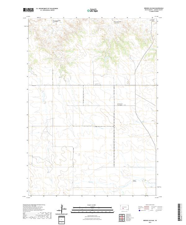
2021 Map of Broken Leg Dam
USGS Topo · Published 2021About this map
Broken Leg Dam sits in the southeastern reaches of this landscape, a prominent landmark in a region defined by extensive drainage basins and creek networks. The geography is dominated by the West Cottonwood Creek Basin, East Cottonwood Creek Basin, and the larger Cottonwood Creek Basin, reflecting a terrain shaped by water management and natural runoff. In this part of Jackson County, the presence of Poor Bear Lake and numerous named watercourses such as Settin Up Cr, Hay Cr, and Long Cr highlights the significance of water resources in this prairie environment. The area is organized by a grid of county roads, including CS 55 and CS 57, which provide access through the vast public and private land survey divisions of T42N and T41N.
Find a feature on this map
25 named features on this map. Tap any name to fly to it.
Don’t see what you’re looking for? This feature index may not catch every label — zoom into the map to look around manually.
Map Details
Editions of this 2021 Broken Leg Dam Map
This is the sole edition of this map. No revisions or reprints were ever made.
Other maps of this area

1950 · Wanblee
USGS Topo · 1:24,000

1951 · Wanblee NW
USGS Topo · 1:24,000

1951 · Pass Creek NW
USGS Topo · 1:24,000

1951 · Wanblee NE
USGS Topo · 1:24,000

1955 · Martin
USGS Topo · 1:250,000

1958 · Martin
USGS Topo · 1:250,000

1980 · Kadoka
USGS Topo · 1:100,000

1981 · Long Valley
USGS Topo · 1:25,000

1981 · Broken Leg Dam
USGS Topo · 1:24,000
1981 · Short Bow Creek
USGS Topo · 1:25,000