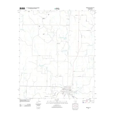
2013 Map of Bronte
USGS Topo · Published 2013About this map
Bronte serves as the focal point of this Coke County landscape, where the intersection of state highways and local streets meets the agricultural and industrial character of West Texas. The town's layout is bordered by the Kickapoo Creek drainage system, including W Kickapoo Creek, Middle Kickapoo Creek, and E Kickapoo Creek. Energy production is a visible part of the economy, evidenced by the Rawlings Oil Field to the north and the Bronte Oil Field just southwest of the town center.
Find a feature on this map
54 named features on this map. Tap any name to fly to it.
Don’t see what you’re looking for? This feature index may not catch every label — zoom into the map to look around manually.
Map Details
Editions of this 2013 Bronte Map
This is the sole edition of this map. No revisions or reprints were ever made.
Other maps of this area

1891 · Hayrick
USGS Topo · 1:125,000

1893 · Sweetwater
USGS Topo · 1:125,000

1894 · Hayrick
USGS Topo · 1:125,000

1921 · Bronte
USGS Topo · 1:31,680

1921 · Maverick
USGS Topo · 1:31,680

1921 · Mays School
USGS Topo · 1:31,680

1954 · Big Spring
USGS Topo · 1:250,000

1954 · San Angelo
USGS Topo · 1:250,000

1958 · San Angelo
USGS Topo · 1:250,000

1958 · Big Spring
USGS Topo · 1:250,000