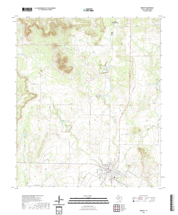
2022 Map of Bronte
USGS Topo · Published 2022About this map
Bronte and the historic site of Fort Chadbourne anchor this West Texas landscape, where the plateau meets the drainage basins of Kickapoo Cr. The township of Bronte shows a distinct street grid, including historic thoroughfares like W Main St and E Main St, with Fairview Cem situated on its southern edge. North of the town, the terrain is defined by prominent elevations such as Kickapoo Mtn, Nipple Peak, and Jones Peak, creating a series of natural gaps and canyons including Panther Gap and Deadman Canyon. A system of man-made water management is evident through numerous reservoirs like Soil Conservation Service Site 2 Reservoir and the Edward Rawling Lower Tank, illustrating the region's reliance on managed water resources for ranching and agriculture. The map also traces the legacy of Fort Chadbourne in the north, marked by its namesake cemetery and the crossing of Middle Kickapoo Cr.
Find a feature on this map
57 named features on this map. Tap any name to fly to it.
Don’t see what you’re looking for? This feature index may not catch every label — zoom into the map to look around manually.
Map Details
Editions of this 2022 Bronte Map
This is the sole edition of this map. No revisions or reprints were ever made.
Other maps of this area

1891 · Hayrick
USGS Topo · 1:125,000

1893 · Sweetwater
USGS Topo · 1:125,000

1894 · Hayrick
USGS Topo · 1:125,000

1921 · Bronte
USGS Topo · 1:31,680

1921 · Maverick
USGS Topo · 1:31,680

1921 · Mays School
USGS Topo · 1:31,680

1954 · Big Spring
USGS Topo · 1:250,000

1954 · San Angelo
USGS Topo · 1:250,000

1958 · San Angelo
USGS Topo · 1:250,000

1958 · Big Spring
USGS Topo · 1:250,000