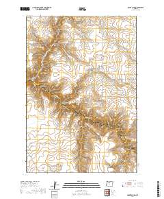
2020 Map of Bronx Canyon
USGS Topo · Published 2020About this map
Buck Hollow Cr carves a deep path through the boundary of Sherman and Wasco counties, defining the complex drainage system of this Central Oregon landscape. The area is characterized by a dense network of named geographic features, including Bronx Canyon and Buck Hollow, which gather runoff from numerous smaller tributaries like Karlen Draw and Wilson Draw. The sparse road network, including Finnegan Rd and Bakeoven Rd, follows the high ridges and plateaus above these incisions.
Find a feature on this map
33 named features on this map. Tap any name to fly to it.
Don’t see what you’re looking for? This feature index may not catch every label — zoom into the map to look around manually.
Map Details
Editions of this 2020 Bronx Canyon Map
This is the sole edition of this map. No revisions or reprints were ever made.
Other maps of this area

1953 · The Dalles
USGS Topo · 1:250,000

1956 · The Dalles
USGS Topo · 1:250,000

1957 · The Dalles
USGS Topo · 1:250,000

1962 · Sinamox
USGS Topo · 1:24,000

1962 · Grass Valley
USGS Topo · 1:24,000

1970 · Kent
USGS Topo · 1:24,000

1970 · Macken Canyon
USGS Topo · 1:24,000

1970 · Rosebush
USGS Topo · 1:24,000
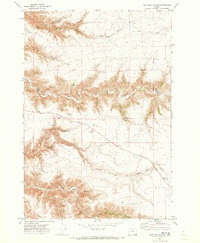
1971 · Dead Dog Canyon
USGS Topo · 1:24,000
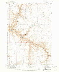
1971 · Bronx Canyon
USGS Topo · 1:24,000