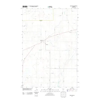
2013 Map of Brook Park
USGS Topo · Published 2013About this map
Brook Park sits as the central settlement in this portion of Pine County, positioned where MN-23 and Old Hwy 23 intersect. The landscape is defined by the winding course of Pokegama Creek and its tributaries, including E Pokegama Cr, which flow toward Pokegama Lake in the southern reaches of the quadrangle. For those researching local history or genealogy, the map identifies significant land markers such as Brook Park Cem and Emmanuel Lutheran Cem near the town center. The survey also captures the transition between Kanabec Co and Pine Co, showing a network of rural roads like Co Hwy-13 and Co Hwy-14 that connect isolated farmsteads across the undulating terrain. The pattern of development follows the established highway corridors, leaving much of the surrounding area to the natural drainage of the Pokegama system.
Find a feature on this map
33 named features on this map. Tap any name to fly to it.
Don’t see what you’re looking for? This feature index may not catch every label — zoom into the map to look around manually.
Map Details
Editions of this 2013 Brook Park Map
This is the sole edition of this map. No revisions or reprints were ever made.
Other maps of this area

1953 · Duluth
USGS Topo · 1:250,000

1953 · Stillwater
USGS Topo · 1:250,000

1955 · Stillwater
USGS Topo · 1:250,000

1958 · Stillwater
USGS Topo · 1:250,000

1958 · Duluth
USGS Topo · 1:250,000

1961 · Sandstone
USGS Topo · 1:62,500

1961 · Brook Park
USGS Topo · 1:62,500

1961 · Pine City
USGS Topo · 1:62,500

1965 · Stillwater
USGS Topo · 1:250,000

1968 · Pomroy Lake
USGS Topo · 1:24,000