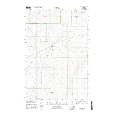
2016 Map of Brook Park
USGS Topo · Published 2016About this map
Brook Park serves as the central hub of this northern landscape, where the boundary between Kanabec County and Pine County meets a terrain defined by complex wetlands and drainage. The settlement's history is anchored by local landmarks such as Brook Park Cemetery and Emmanuel Lutheran Cemetery, providing valuable points of reference for genealogists. The natural hydrology is dominated by the winding path of Pokegama Creek, which flows southeast toward Pokegama Lake. This modern survey illustrates how a grid of rural roads, including Crosspark Road and Sunny Hill Road, has been adapted to the marshy environment, with many routes skirting the numerous unnamed ponds and wetlands that characterize this portion of the Minnesota interior.
Find a feature on this map
60 named features on this map. Tap any name to fly to it.
Don’t see what you’re looking for? This feature index may not catch every label — zoom into the map to look around manually.
Map Details
Editions of this 2016 Brook Park Map
This is the sole edition of this map. No revisions or reprints were ever made.
Other maps of this area

1953 · Duluth
USGS Topo · 1:250,000

1953 · Stillwater
USGS Topo · 1:250,000

1955 · Stillwater
USGS Topo · 1:250,000

1958 · Stillwater
USGS Topo · 1:250,000

1958 · Duluth
USGS Topo · 1:250,000

1961 · Sandstone
USGS Topo · 1:62,500

1961 · Brook Park
USGS Topo · 1:62,500

1961 · Pine City
USGS Topo · 1:62,500

1965 · Stillwater
USGS Topo · 1:250,000

1968 · Pomroy Lake
USGS Topo · 1:24,000