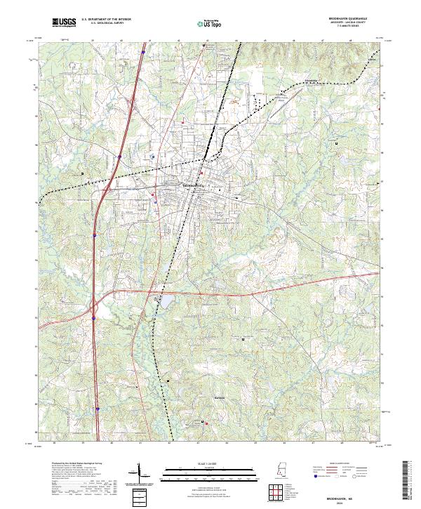
2024 Map of Brookhaven
USGS Topo · Published 2024About this map
Brookhaven serves as the focal point of this Lincoln County survey, situated where the Canadian National RR intersects with a network of modern thoroughfares like I-55 and Us HWY 51. The landscape is defined by the winding paths of the West Bogue Chitto and East Bogue Chitto, which converge to form the Bogue Chitto river system. This area reflects a long-standing pattern of community development, evidenced by the numerous cemeteries including Rose Hill Cem and Easthaven Cem near the town center, and more rural sites like Zion Hill Cem and Godman Cem on the outskirts. The presence of the Lincoln County-Brookhaven Government Complex and the Brookhaven-Lincoln County Airport indicates the city's role as a regional hub. Southward, the terrain becomes increasingly rural towards Hartman, where landmarks like the Mount Moriah Baptist Church and several small tributaries like Doolittle Creek and Jordan Creek shape the rural geography.
Find a feature on this map
191 named features on this map. Tap any name to fly to it.
Don’t see what you’re looking for? This feature index may not catch every label — zoom into the map to look around manually.
Map Details
Editions of this 2024 Brookhaven Map
This is the sole edition of this map. No revisions or reprints were ever made.
Other maps of this area

1953 · Natchez
USGS Topo · 1:250,000

1956 · Natchez
USGS Topo · 1:250,000

1959 · Natchez
USGS Topo · 1:250,000

1972 · West Lincoln
USGS Topo · 1:24,000

1972 · Fair Oak Springs
USGS Topo · 1:24,000

1972 · Midway
USGS Topo · 1:24,000

1972 · Ruth
USGS Topo · 1:24,000

1972 · Bogue Chitto
USGS Topo · 1:24,000
1972 · Stronghope
USGS Topo · 1:24,000

1972 · Brookhaven
USGS Topo · 1:24,000