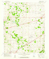
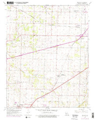
1960 Map of Brookline
USGS Topo · Published 1961About this map
The ST Louis San Francisco railroad corridor serves as the primary artery through this Greene County landscape, connecting the town of Republic and the settlement of Brookline. At this time in the early 1960s, the region is undergoing significant infrastructure changes, most notably seen in the highway segments labeled Under Construction that cut across the central terrain. The northeastern corner is dominated by the Springfield Municipal Airport and its nearby Microwave Towers, indicating the area's growing importance as a transportation and communication hub.
Find a feature on this map
33 named features on this map. Tap any name to fly to it.
Don’t see what you’re looking for? This feature index may not catch every label — zoom into the map to look around manually.
Map Details
Editions of this 1960 Brookline Map
5 editions found
Other maps of this area

1884 · Springfield
USGS Topo · 1:125,000

1886 · Greenfield
USGS Topo · 1:125,000

1886 · Springfield
USGS Topo · 1:125,000

1888 · Greenfield
USGS Topo · 1:125,000

1919 · Halltown
USGS Topo · 1:62,500

1935 · Springfield
USGS Topo · 1:24,000

1936 · Brookline
USGS Topo · 1:24,000

1948 · Willard
USGS Topo · 1:24,000

1948 · Ebenezer
USGS Topo · 1:24,000

1954 · Springfield
USGS Topo · 1:250,000