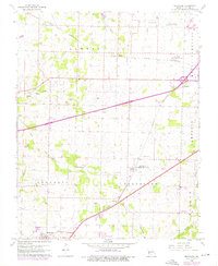
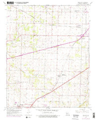
1960 Map of Brookline
USGS Topo · Published 1976About this map
Brookline and Republic anchor this mid-century portrait of Greene County, where the infrastructure of transportation and regional aviation was rapidly evolving. The St Louis San Francisco railroad cuts diagonally across the landscape, connecting small communities like Elwood and Haseltine to the larger hubs. The map reveals a transition from traditional agricultural land to modern utility, evidenced by the proximity of Springfield Municipal Airport and the smaller Westport Landing Field. Local family history is preserved in several burial grounds, including White Chapel Memorial Gardens Cemetery, Evergreen Cem, and Harrington Cem. Water features such as the Sac River and Dailey Spring contrast with industrial markers like the Quarry and Radio Tower Substation, illustrating a landscape in flux as rural townships like North Campbell and Wilson began to interface with expanding municipal boundaries.
Find a feature on this map
31 named features on this map. Tap any name to fly to it.
Don’t see what you’re looking for? This feature index may not catch every label — zoom into the map to look around manually.
Map Details
Editions of this 1960 Brookline Map
5 editions found
Other maps of this area

1884 · Springfield
USGS Topo · 1:125,000

1886 · Greenfield
USGS Topo · 1:125,000

1886 · Springfield
USGS Topo · 1:125,000

1888 · Greenfield
USGS Topo · 1:125,000

1919 · Halltown
USGS Topo · 1:62,500

1935 · Springfield
USGS Topo · 1:24,000

1936 · Brookline
USGS Topo · 1:24,000

1948 · Willard
USGS Topo · 1:24,000

1948 · Ebenezer
USGS Topo · 1:24,000

1954 · Springfield
USGS Topo · 1:250,000