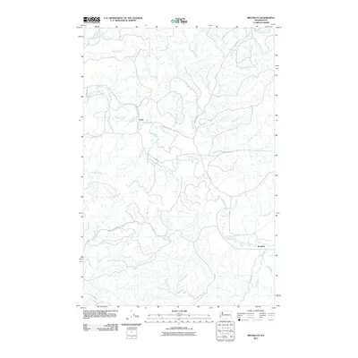
2011 Map of Brooklyn
USGS Topo · Published 2011About this map
North River serves as the central drainage for this section of southwest Washington, where a dense network of watercourses defines the timber-rich landscape. The small settlements of Vesta and Brooklyn anchor the region, connected by winding logging and secondary roads like N River Rd and Fall River Rd. The terrain is deeply incised by major tributaries including Smith Creek, Pioneer Creek, and Vesta Creek, while named logging routes such as the O Line and Z Line Rd suggest a history of industrial forest access. The map details how early twentieth-century settlement patterns followed the valley floors, particularly near the confluence of the Fall River and the North River, providing researchers with a clear view of the area's rural development and river-dependent geography.
Find a feature on this map
28 named features on this map. Tap any name to fly to it.
Don’t see what you’re looking for? This feature index may not catch every label — zoom into the map to look around manually.
Map Details
Editions of this 2011 Brooklyn Map
This is the sole edition of this map. No revisions or reprints were ever made.
Other maps of this area

1940 · Montesano
USGS Topo · 1:62,500

1941 · Walville
USGS Topo · 1:62,500

1941 · Ford
USGS Topo · 1:62,500

1953 · Hoquiam
USGS Topo · 1:250,000

1953 · Pe Ell
USGS Topo · 1:62,500

1953 · Malone
USGS Topo · 1:62,500

1955 · Montesano
USGS Topo · 1:62,500

1955 · Raymond
USGS Topo · 1:62,500

1957 · Hoquiam
USGS Topo · 1:250,000

1958 · Hoquiam
USGS Topo · 1:250,000