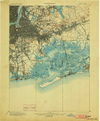
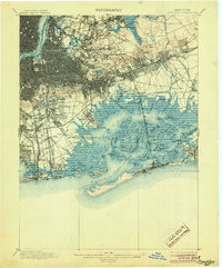
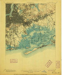
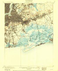
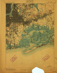
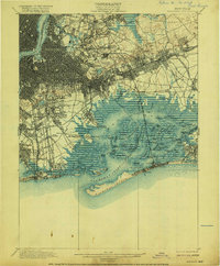
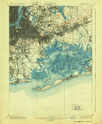
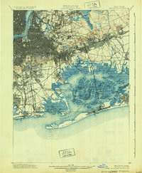
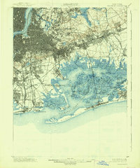
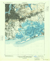
1900 Map of Brooklyn
USGS Topo · Published 1903About this map
Cypress Hills Cemetery and the sprawling Evergreen Cemetery form a massive green belt at the dawn of the twentieth century, marking the transition from the dense urban grid of Ridgewood and Woodhaven into the marshy expanses of Jamaica Bay. This survey illustrates a pivotal era where rural settlements like Flatbush and Jamaica were rapidly integrating into the city's expanding infrastructure. The complex shoreline of the bay is yet untouched by modern reclamation, defined by a labyrinth of tidal channels including Pumpkinpatch Channel and islands such as Canarsie Pol and Ruffle Bar.
Find a feature on this map
140 named features on this map. Tap any name to fly to it.
Don’t see what you’re looking for? This feature index may not catch every label — zoom into the map to look around manually.
Map Details
Editions of this 1900 Brooklyn Map
11 editions found

1900 edition
16.6 x 20 inches
1903 edition
16.6 x 20 inches
1905 edition
16.6 x 20 inches
1906 edition
16.6 x 20 inches
1908 edition
15.99 x 19.83 inches
1910 edition
15.7 x 19.8 inches
1916 edition
16.4 x 19.8 inches
1924 edition
16.4 x 19.9 inches
1931 edition
16.3 x 19.8 inches
1938 edition
16.4 x 19.7 inches
1948 edition
17 x 20.9 inches
Other maps of this area

1888 · Paterson
USGS Topo · 1:62,500

1888 · Sandy Hook
USGS Topo · 1:62,500

1889 · Brooklyn
USGS Topo · 1:62,500

1891 · Brooklyn
USGS Topo · 1:62,500

1891 · Harlem
USGS Topo · 1:62,500

1892 · Paterson
USGS Topo · 1:62,500

1893 · Sandy Hook
USGS Topo · 1:62,500

1897 · Harlem
USGS Topo · 1:62,500

1897 · Brooklyn
USGS Topo · 1:62,500

1897 · Hempstead
USGS Topo · 1:62,500