
Loading...
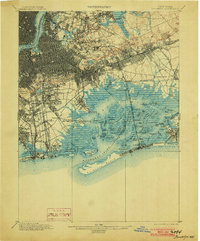
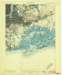
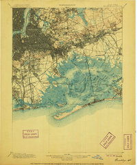
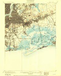
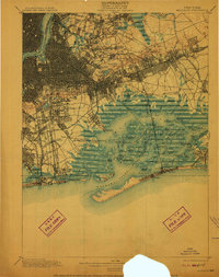
Loading map...1900 Map of Brooklyn
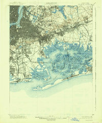
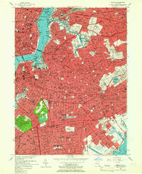
USGS Topo · Published 1900This historical map portrays the area of Brooklyn in 1900, primarily covering Kings County as well as portions of New Jersey. Featuring a scale of 1:62500, this map provides a highly detailed snapshot of the terrain, roads, buildings, counties, and historical landmarks in the Brooklyn region at the time. Published in 1900, it is one of 11 known editions of this map due to revisions or reprints.
Map Details
Date Portrayed1900
Date Published1900
PublisherU.S. Geological Survey
Map TypeTopographic
Scale1:62500
Physical Dimensions16.6 x 20 inches
Editions of this 1900 Brooklyn Map
11 editions found
1900 edition
16.6 x 20 inches
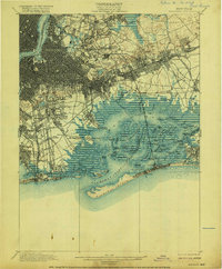
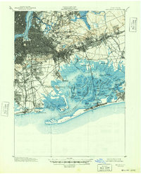
1903 edition
16.6 x 20 inches
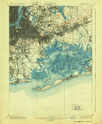
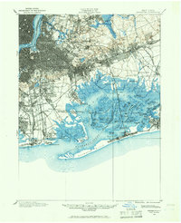
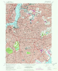
1905 edition
16.6 x 20 inches
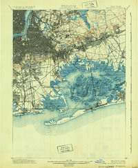
1906 edition
16.6 x 20 inches
1908 edition
15.99 x 19.83 inches
1910 edition
15.7 x 19.8 inches
1916 edition
16.4 x 19.8 inches
1924 edition
16.4 x 19.9 inches
1931 edition
16.3 x 19.8 inches
1938 edition
16.4 x 19.7 inches
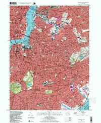
1948 edition
17 x 20.9 inches
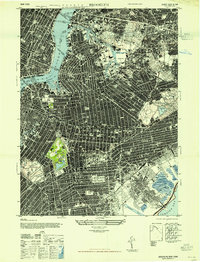
Historical Maps of Hempstead Through Time
9 maps found


Featured Locations
Source Details
SourceU.S. Geological Survey
CopyrightPublic Domain