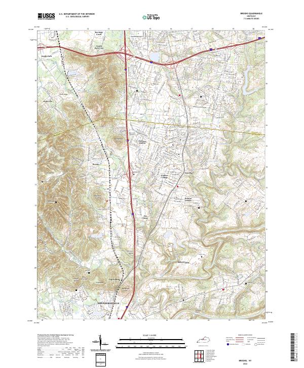
2022 Map of Brooks
USGS Topo · Published 2022About this map
Brooks and the surrounding Bullitt County landscape are defined by the distinctive knobs and gaps that rise above the Floyds Fork and Salt River floodplains. The terrain transitions from the residential developments of Hebron Estates and Hillview into the varied topography of Buttonmold Knob and Wagonbed Knob. This modern survey illustrates how infrastructure like I-65 and KY 61 has facilitated the growth of communities such as Pioneer Village and Hunters Hollow, while older family landmarks remain in the landscape.
Find a feature on this map
48 named features on this map. Tap any name to fly to it.
Don’t see what you’re looking for? This feature index may not catch every label — zoom into the map to look around manually.
Map Details
Editions of this 2022 Brooks Map
This is the sole edition of this map. No revisions or reprints were ever made.
Other maps of this area

1907 · Louisville
USGS Topo · 1:62,500

1909 · Kosmosdale
USGS Topo · 1:48,000

1912 · Kosmosdale
USGS Topo · 1:62,500

1936 · Vine Grove
USGS Topo · 1:62,500

1943 · Vine Grove
USGS Topo · 1:62,500

1946 · Pitts Point
USGS Topo · 1:24,000

1946 · Vine Grove
USGS Topo · 1:62,500

1949 · Shepherdsville
USGS Topo · 1:24,000

1949 · Samuels
USGS Topo · 1:24,000

1949 · Shepherdsville
USGS Topo · 1:62,500