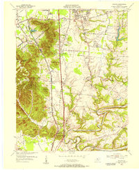
1955 Map of Brooks
USGS Topo · Published 1956About this map
The South Park Hills dominate the northwestern terrain of this mid-1950s survey, marking a transition from the developing outskirts of Louisville into the more industrial and agricultural corridor of Bullitt County. The Louisville and Nashville railroad runs through the heart of the area, serving the settlement of Brooks and the industrial activity at Hubers (Kenlite Sta). This era captures the early footprint of the Kentucky Turnpike as it cuts north-to-south, paralleling the older Preston Highway and National Turnpike.
Find a feature on this map
63 named features on this map. Tap any name to fly to it.
Don’t see what you’re looking for? This feature index may not catch every label — zoom into the map to look around manually.
Map Details
Editions of this 1955 Brooks Map
This is the sole edition of this map. No revisions or reprints were ever made.
Other maps of this area

1907 · Louisville
USGS Topo · 1:62,500

1909 · Kosmosdale
USGS Topo · 1:48,000

1912 · Kosmosdale
USGS Topo · 1:62,500

1936 · Vine Grove
USGS Topo · 1:62,500

1943 · Vine Grove
USGS Topo · 1:62,500

1946 · Pitts Point
USGS Topo · 1:24,000

1946 · Vine Grove
USGS Topo · 1:62,500

1949 · Shepherdsville
USGS Topo · 1:24,000

1949 · Samuels
USGS Topo · 1:24,000

1949 · Shepherdsville
USGS Topo · 1:62,500