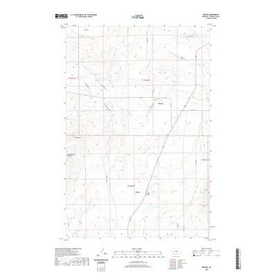
2020 Map of Brooks
USGS Topo · Published 2020About this map
The South Moccasin Mountains anchor the western edge of this landscape, rising above the rolling plains of central Montana near the small settlements of Brooks and Baxter. This 2020 survey illustrates a region defined by its water sources and historical transit routes, such as the Old Denton Cutoff and Denton Cutoff. The drainage patterns of Warm Spring Cr and Moccasin Cr dictate the layout of ranching and agricultural tracts across the foothills. To the south, Carters Pond and Upper Carters Pond provide significant catchment points near Sunset Memorial Gardens. The map also captures distinctive topographic landmarks like Rocky Butte and the high-altitude meadow known as The Park, reflecting the rugged character of the Fergus County interior during the early 21st century.
Find a feature on this map
68 named features on this map. Tap any name to fly to it.
Don’t see what you’re looking for? This feature index may not catch every label — zoom into the map to look around manually.
Map Details
Editions of this 2020 Brooks Map
This is the sole edition of this map. No revisions or reprints were ever made.
Other maps of this area

1941 · Lewistown
USGS Topo · 1:62,500

1944 · Lewistown
USGS Topo · 1:62,500

1954 · Lewistown
USGS Topo · 1:250,000

1959 · Lewistown
USGS Topo · 1:250,000

1970 · Glengarry
USGS Topo · 1:24,000

1970 · Spring Creek Junction
USGS Topo · 1:24,000

1978 · Seventytwo Hills
USGS Topo · 1:24,000

1978 · Lewistown
USGS Topo · 1:100,000
1985 · Kendall
USGS Topo · 1:24,000

1985 · Hilger
USGS Topo · 1:24,000