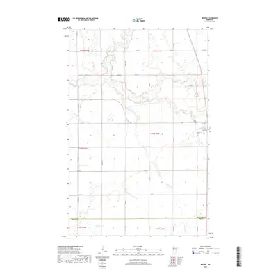
2019 Map of Brooks
USGS Topo · Published 2019About this map
The village of Brooks serves as the primary hub for this agricultural region of Red Lake County, situated at the confluence of several vital waterways and local transport corridors. The landscape is defined by the winding paths of the Clearwater River, Lost River, and Poplar River, which together form a complex drainage system across the prairie. The importance of land management is evident in the presence of County Ditch Number Four, illustrating the transition from natural creek beds like Beau Gerlot Cr and Terrebonne Cr to engineered waterways designed for regional drainage.
Find a feature on this map
46 named features on this map. Tap any name to fly to it.
Don’t see what you’re looking for? This feature index may not catch every label — zoom into the map to look around manually.
Map Details
Editions of this 2019 Brooks Map
This is the sole edition of this map. No revisions or reprints were ever made.
Other maps of this area

1918 · Terrebonne
USGS Topo · 1:62,500

1919 · Grit
USGS Topo · 1:62,500

1919 · Valley
USGS Topo · 1:62,500

1952 · Grand Forks
USGS Topo · 1:250,000

1954 · Bemidji
USGS Topo · 1:250,000

1956 · Grand Forks
USGS Topo · 1:250,000

1957 · Bemidji
USGS Topo · 1:250,000

1958 · Bemidji
USGS Topo · 1:250,000
1964 · Plummer NW
USGS Topo · 1:24,000

1964 · Terrebonne
USGS Topo · 1:24,000