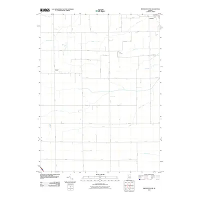
2010 Map of Brookston NW
USGS Topo · Published 2010About this map
Reynolds occupies the northeastern corner of this White County landscape, serving as a primary settlement point in an area defined by sophisticated agricultural drainage and straight-line section roads. The terrain is crisscrossed by an extensive network of waterways designed to manage the fertile prairie land, including Hoagland Ditch, Fraser Ditch, and Dorsey Ditch. These man-made channels run alongside natural features like Honey Creek and Spring Creek, illustrating the long-term engineering required to sustain the region's farming economy.
Find a feature on this map
37 named features on this map. Tap any name to fly to it.
Don’t see what you’re looking for? This feature index may not catch every label — zoom into the map to look around manually.
Map Details
Editions of this 2010 Brookston NW Map
This is the sole edition of this map. No revisions or reprints were ever made.
Other maps of this area

1953 · Danville
USGS Topo · 1:250,000

1955 · Danville
USGS Topo · 1:250,000

1956 · Danville
USGS Topo · 1:250,000

1962 · Brookston SW
USGS Topo · 1:24,000

1962 · Monticello South
USGS Topo · 1:24,000
1962 · Round Grove
USGS Topo · 1:24,000

1962 · Templeton NE
USGS Topo · 1:24,000

1962 · Brookston NW
USGS Topo · 1:24,000

1962 · Monon
USGS Topo · 1:24,000

1962 · Monticello North
USGS Topo · 1:24,000