
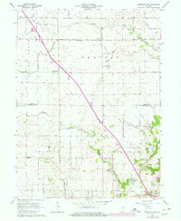
1962 Map of Brookston SW
USGS Topo · Published 1963About this map
The agricultural lands of Wabash and Tippecanoe townships are captured here during the early 1960s, a period characterized by a systematic drainage network of ditches and creeks. This 1962 field check documents several small crossroads communities including Badger Grove, Cairo, and the distinctively named Octagon. The landscape is largely defined by its rural infrastructure, featuring a regular grid of roads like 850 North Road and Brown Road that separate vast tracts of farmland. A notable insight from this survey is the reliance on named drainage systems, such as Myers Ditch and Cole Ditch, which underscore the effort to manage the local hydrology for cultivation. Local heritage is preserved through markers like the Cairo Cemetery, Liberty Chapel, and the Archibald Memorial Home, providing a detailed view of the social fabric in this part of northern Indiana before major modern suburban expansion.
Find a feature on this map
30 named features on this map. Tap any name to fly to it.
Don’t see what you’re looking for? This feature index may not catch every label — zoom into the map to look around manually.
Map Details
Editions of this 1962 Brookston SW Map
2 editions found
Other maps of this area

1941 · Lafayette
USGS Topo · 1:24,000

1942 · Otterbein
USGS Topo · 1:24,000

1942 · Lafayette
USGS Topo · 1:24,000

1950 · Lafayette
USGS Topo · 1:24,000

1951 · Otterbein
USGS Topo · 1:24,000

1953 · Danville
USGS Topo · 1:250,000

1955 · Danville
USGS Topo · 1:250,000

1956 · Danville
USGS Topo · 1:250,000

1961 · Lafayette East
USGS Topo · 1:24,000

1961 · Otterbein
USGS Topo · 1:24,000