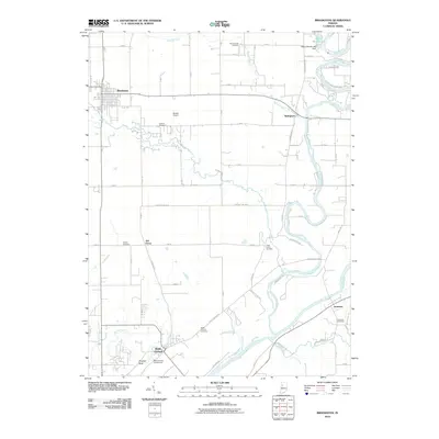
2010 Map of Brookston
USGS Topo · Published 2010About this map
The Tippecanoe River carves a winding path through the eastern portion of this landscape, eventually meeting the Wabash River near the settlement of Americus. This area is rich in sites of local memory, from the Battle Ground community and its namesake Battle Ground Cemetery to the landmark at Prophet Rock. The map reveals a rural infrastructure of small airstrips like Bartlett Airport and scattered family or community burial grounds including Smelcer Cemetery and Harvey Cemetery. Agriculture and hydrology dominate the terrain, defined by the convergence of Moots Creek, Burnett Creek, and Spring Creek. The layout of local routes, such as Pretty Prairie Rd and Indian Bluff Rd, suggests a landscape deeply connected to its river valleys and historical landmarks.
Find a feature on this map
70 named features on this map. Tap any name to fly to it.
Don’t see what you’re looking for? This feature index may not catch every label — zoom into the map to look around manually.
Map Details
Editions of this 2010 Brookston Map
This is the sole edition of this map. No revisions or reprints were ever made.
Other maps of this area

1941 · Lafayette
USGS Topo · 1:24,000

1942 · Lafayette
USGS Topo · 1:24,000

1950 · Lafayette
USGS Topo · 1:24,000

1953 · Danville
USGS Topo · 1:250,000

1955 · Danville
USGS Topo · 1:250,000

1956 · Danville
USGS Topo · 1:250,000

1961 · Pyrmont
USGS Topo · 1:24,000

1961 · Lafayette East
USGS Topo · 1:24,000
1961 · Lafayette West
USGS Topo · 1:24,000

1962 · Brookston SW
USGS Topo · 1:24,000