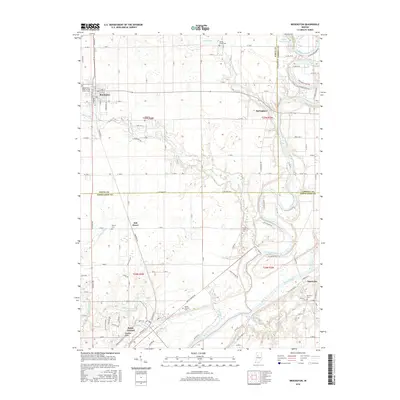
2016 Map of Brookston
USGS Topo · Published 2016About this map
The confluence area of the Tippecanoe River and Wabash River anchors this study of north-central Indiana, where the borders of White, Carroll, and Tippecanoe counties meet. The settlement of Battle Ground is a focal point for researchers, home to the Battle Ground Cem and the distinctive landmark of Prophet Rock near the riverbanks. To the north, the town of Brookston serves as a local hub, established on the prairie landscape between Chilton Ditch and the winding course of Moots Creek. The map provides a high level of detail for genealogists, documenting numerous burial sites including the Independent Order of Odd Fellows Cem, Spring Creek Cem, and Pretty Prairie Cem. This rural landscape is defined by its drainage and transport patterns, from the Walters Ditch irrigation networks to the small riverside communities of Springboro and Americus, the latter situated right at the bend of the Wabash.
Find a feature on this map
117 named features on this map. Tap any name to fly to it.
Don’t see what you’re looking for? This feature index may not catch every label — zoom into the map to look around manually.
Map Details
Editions of this 2016 Brookston Map
This is the sole edition of this map. No revisions or reprints were ever made.
Other maps of this area

1941 · Lafayette
USGS Topo · 1:24,000

1942 · Lafayette
USGS Topo · 1:24,000

1950 · Lafayette
USGS Topo · 1:24,000

1953 · Danville
USGS Topo · 1:250,000

1955 · Danville
USGS Topo · 1:250,000

1956 · Danville
USGS Topo · 1:250,000

1961 · Pyrmont
USGS Topo · 1:24,000

1961 · Lafayette East
USGS Topo · 1:24,000
1961 · Lafayette West
USGS Topo · 1:24,000

1962 · Brookston SW
USGS Topo · 1:24,000