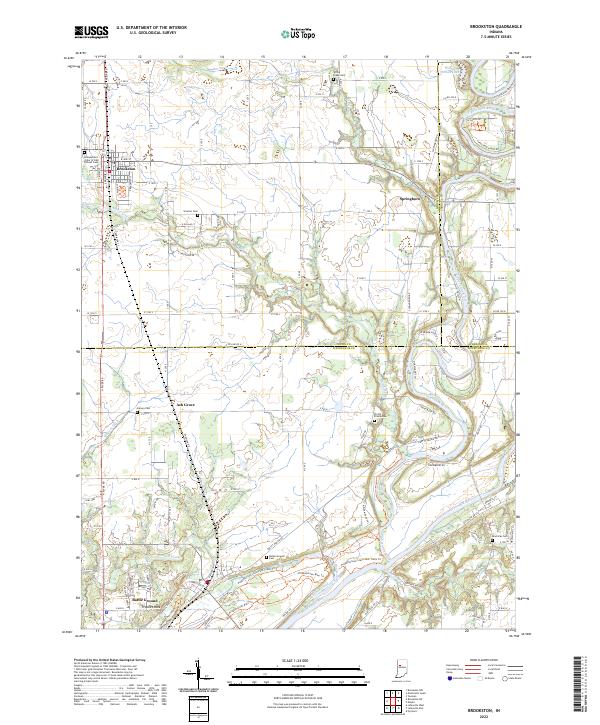
2022 Map of Brookston
USGS Topo · Published 2022About this map
Tippecanoe River and Wabash River define the lower reach of this landscape, where the town of Battle Ground sits near the site of Prophet Rock. The map illustrates a transition from the agricultural plateaus of White Co into the more complex riverine topography of Tippecanoe Co. A dense network of local roads connects several long-established burial grounds, including the Independent Order of Odd Fellows Cem near Brookston and the Americus Cem overlooking the river valley. For the historian or genealogist, the map details many smaller cemeteries such as Smelcer Cem and Harvey Cem that anchor the family histories of former settlements like Ash Grove and Springboro. Modern recreation is represented by the Prophetstown State Park Trails Trl, which winds along the river bluffs near the convergence of Harrison Creek and Burnett Creek.
Find a feature on this map
126 named features on this map. Tap any name to fly to it.
Don’t see what you’re looking for? This feature index may not catch every label — zoom into the map to look around manually.
Map Details
Editions of this 2022 Brookston Map
This is the sole edition of this map. No revisions or reprints were ever made.
Other maps of this area

1941 · Lafayette
USGS Topo · 1:24,000

1942 · Lafayette
USGS Topo · 1:24,000

1950 · Lafayette
USGS Topo · 1:24,000

1953 · Danville
USGS Topo · 1:250,000

1955 · Danville
USGS Topo · 1:250,000

1956 · Danville
USGS Topo · 1:250,000

1961 · Pyrmont
USGS Topo · 1:24,000

1961 · Lafayette East
USGS Topo · 1:24,000
1961 · Lafayette West
USGS Topo · 1:24,000

1962 · Brookston SW
USGS Topo · 1:24,000