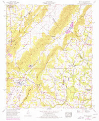
1958 Map of Brooksville
USGS Topo · Published 1976About this map
Sand Mountain and the prominent Browns Valley dominate this North Alabama landscape, where the Tennessee River Divide snakes through the high country of Blount, Marshall, and Cullman counties. The 1958 field check shows a rural society defined by small churches and family burial grounds, such as Pleasant Grove Ch and Alldredge Cem. In the lower elevations near Brooksville, several minnow hatcheries indicate the specialized local aquaculture of the era, while the Locust Fork Black Warrior River flows through the southern section of the quadrangle.
Find a feature on this map
69 named features on this map. Tap any name to fly to it.
Don’t see what you’re looking for? This feature index may not catch every label — zoom into the map to look around manually.
Map Details
Editions of this 1958 Brooksville Map
3 editions found
Other maps of this area

1885 · Gadsden
USGS Topo · 1:125,000

1888 · Cullman
USGS Topo · 1:125,000

1888 · Gadsden
USGS Topo · 1:125,000

1892 · Cullman
USGS Topo · 1:125,000

1892 · Gadsden
USGS Topo · 1:125,000

1895 · Gadsden
USGS Topo · 1:125,000

1903 · Gadsden
USGS Topo · 1:125,000

1936 · Guntersville
USGS Topo · 1:24,000

1936 · Hulaco
USGS Topo · 1:24,000

1936 · Arab
USGS Topo · 1:24,000