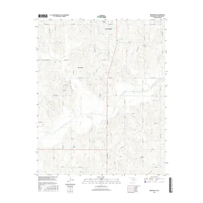
2016 Map of Brooksville
USGS Topo · Published 2016About this map
Brooksville and the southern outskirts of Tecumseh anchor this 2016 topographic study of central Pottawatomie County. The landscape is characterized by the winding course of the Little River, which bisects the area amidst a network of private water holdings and reservoirs. The distribution of small family and community burial grounds, such as Forest Hill Cem and Ruggles Cem, provides a significant inventory for genealogical research in this part of Oklahoma. These sites are tucked away among local thoroughfares like Dancing Stream Spur Rd and Brooksville Rd. The terrain is punctuated by several named impoundments, including the Jesse McGaha Reservoir and Audrey Crown Reservoir, illustrating the modern management of the local watershed and drainage into Dance Cr and Sand Cr.
Find a feature on this map
41 named features on this map. Tap any name to fly to it.
Don’t see what you’re looking for? This feature index may not catch every label — zoom into the map to look around manually.
Map Details
Editions of this 2016 Brooksville Map
This is the sole edition of this map. No revisions or reprints were ever made.
Other maps of this area

1896 · Seminole and Prague
USGS Topo · 1:125,000

1898 · Purcell
USGS Topo · 1:125,000

1907 · Maud
USGS Topo · 1:62,500

1908 · Maud
USGS Topo · 1:62,500

1909 · Shawnee
USGS Topo · 1:62,500

1910 · McComb
USGS Topo · 1:62,500

1930 · McLoud
USGS Topo · 1:62,500

1954 · Oklahoma City
USGS Topo · 1:250,000

1957 · Oklahoma City
USGS Topo · 1:250,000
1958 · Tribbey
USGS Topo · 1:24,000