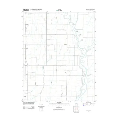
2011 Map of Broseley
USGS Topo · Published 2011About this map
Higginbothams Ferry provides a focal point along the Saint Francis River in this section of Butler County, where the landscape is defined by an extensive drainage network. The terrain is crisscrossed by engineered waterways like Ditch Number 18 and Menorkanut Slough Number 19, reflecting a highly managed agricultural environment. Small community clusters such as Broseley, Hicoria Spur, and Nyssa are linked by a grid of county roads, while local history is anchored by Vale Cemetery and Browns Cemetery. Along the river, natural features like Upper Shoals and Lower Shoals stand in contrast to the rigid drainage lines, illustrating the intersection of the river's original path with local irrigation and flood control efforts.
Find a feature on this map
64 named features on this map. Tap any name to fly to it.
Don’t see what you’re looking for? This feature index may not catch every label — zoom into the map to look around manually.
Map Details
Editions of this 2011 Broseley Map
This is the sole edition of this map. No revisions or reprints were ever made.
Other maps of this area

1934 · Puxico
USGS Topo · 1:62,500

1935 · Poplar Bluff
USGS Topo · 1:62,500

1935 · Harviell
USGS Topo · 1:62,500

1939 · Puxico
USGS Topo · 1:62,500

1939 · Poplar Bluff
USGS Topo · 1:62,500

1940 · Valley Ridge
USGS Topo · 1:62,500

1949 · Poplar Bluff
USGS Topo · 1:62,500

1956 · Valley Ridge
USGS Topo · 1:62,500

1957 · Poplar Bluff
USGS Topo · 1:250,000

1959 · Poplar Bluff
USGS Topo · 1:250,000