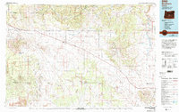
1983 Map of Brothers
USGS Topo · Published 1994About this map
Millican and Brothers serve as the primary human outposts in this expansive high-desert landscape during the early 1980s. The region is defined by a series of prominent volcanic features and broad valleys, including the Bear Creek Buttes and the wide Millican Valley. Transportation and utility infrastructure are scattered across the terrain, notably a Landing Strip and a Substation Heliport, which suggest the logistical challenges of managing such a remote expanse. The map also delineates the intersection of Deschutes National Forest and Ochoco National Forest land, showcasing how federal management shaped the conservation and usage of these arid uplands. Water is a scarce and vital resource here, marked by seasonal features like Sunflower Lake, Benjamine Lake, and the intermittent Dry River. These sources, along with the Fahrenbacker Reservoir, illustrate the critical water-management patterns essential for ranching and survival in the Oregon interior.
Find a feature on this map
34 named features on this map. Tap any name to fly to it.
Don’t see what you’re looking for? This feature index may not catch every label — zoom into the map to look around manually.
Map Details
Editions of this 1983 Brothers Map
2 editions found
Other maps of this area

1926 · Bend
USGS Topo · 1:125,000

1929 · Bend
USGS Topo · 1:125,000

1931 · Newberry Crater
USGS Topo · 1:125,000

1932 · Dayville
USGS Topo · 1:125,000

1935 · Newberry Crater
USGS Topo · 1:125,000

1936 · Dayville
USGS Topo · 1:125,000

1946 · Eagle Rock
USGS Topo · 1:62,500

1948 · Eagle Rock
USGS Topo · 1:62,500

1951 · Post
USGS Topo · 1:62,500

1955 · Crescent
USGS Topo · 1:250,000