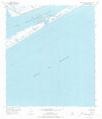
1952 Map of Brown Cedar Cut
USGS Topo · Published 1973About this map
Brown Cedar Cut serves as a critical hydrologic artery on this 1950s survey, connecting the saline waters of the Gulf of Mexico with the sheltered expanse of East Matagorda Bay. The map highlights the delicate geography of the Matagorda Peninsula, a narrow barrier of land shaped by coastal dynamics. Along the inland side of the peninsula, the Intracoastal Waterway is marked with a project depth of 12 feet, reflecting the era's focus on maintaining navigable maritime trade routes through the Texas coastal bend.
Find a feature on this map
12 named features on this map. Tap any name to fly to it.
Don’t see what you’re looking for? This feature index may not catch every label — zoom into the map to look around manually.
Map Details
Editions of this 1952 Brown Cedar Cut Map
2 editions found
Other maps of this area

1951 · Bay City
USGS Topo · 1:250,000

1952 · Lake Austin
USGS Topo · 1:24,000

1952 · Dressing Point
USGS Topo · 1:24,000

1952 · Cedar Lakes West
USGS Topo · 1:24,000
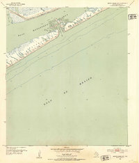
1952 · Brown Cedar Cut
USGS Topo · 1:24,000

1952 · Sargent
USGS Topo · 1:24,000

1956 · Bay City
USGS Topo · 1:250,000

1958 · Bay City
USGS Topo · 1:250,000
1974 · Bay City
USGS Topo · 1:250,000
2010 · Sargent
USGS Topo · 1:24,000