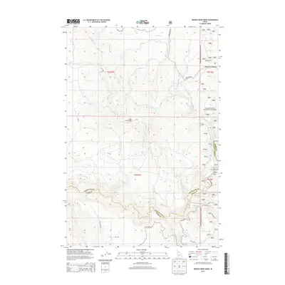
2014 Map of Brown Creek Ridge
USGS Topo · Published 2014About this map
Brown Creek Ridge dominates the central landscape of this Idaho interior, where the boundary between Clearwater Co and Idaho Co follows the winding course of Lolo Creek. The area is defined by a dense network of mountain drainages, including the oddly named Pete and Charlie Cr and Mosquito Cr. This 2014 survey captures a region managed largely by the Clearwater National Forest, showing a landscape partitioned by timber and conservation interests rather than urban development.
Find a feature on this map
36 named features on this map. Tap any name to fly to it.
Don’t see what you’re looking for? This feature index may not catch every label — zoom into the map to look around manually.
Map Details
Editions of this 2014 Brown Creek Ridge Map
This is the sole edition of this map. No revisions or reprints were ever made.
Other maps of this area

1924 · Weippe
USGS Topo · 1:125,000

1956 · Hamilton
USGS Topo · 1:250,000

1959 · Hamilton
USGS Topo · 1:250,000

1960 · Hamilton
USGS Topo · 1:250,000

1964 · Hamilton
USGS Topo · 1:250,000

1966 · Kooskia
USGS Topo · 1:24,000

1966 · Pierce
USGS Topo · 1:24,000
1966 · Glenwood
USGS Topo · 1:24,000
1966 · Hemlock Butte
USGS Topo · 1:24,000
1966 · Brown Creek Ridge
USGS Topo · 1:24,000