
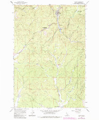
1966 Map of Pierce
USGS Topo · Published 1968About this map
The town of Pierce serves as the focal point of this mid-1960s survey, situated along the upper reaches of Orofino Creek within the Clearwater National Forest. As the site of Idaho's first major gold discovery, the area’s timber and mining heritage is reflected in landmarks like Judge Town and the Hanging Trees Historical Marker. The landscape is a network of steep drainages and timbered ridges, including Dan Lee Ridge and Gold Hill, where isolated industrial sites such as Cardiff Mill and Brown Creek Mill indicate the local economic drivers of the era.
Find a feature on this map
42 named features on this map. Tap any name to fly to it.
Don’t see what you’re looking for? This feature index may not catch every label — zoom into the map to look around manually.
Map Details
Editions of this 1966 Pierce Map
2 editions found
Other maps of this area

1923 · Washington Creek
USGS Topo · 1:125,000

1924 · Weippe
USGS Topo · 1:125,000

1938 · Headquarters
USGS Topo · 1:48,000

1944 · Headquarters
USGS Topo · 1:62,500

1956 · Hamilton
USGS Topo · 1:250,000

1959 · Hamilton
USGS Topo · 1:250,000

1960 · Hamilton
USGS Topo · 1:250,000

1964 · Hamilton
USGS Topo · 1:250,000

1965 · French Mountain
USGS Topo · 1:24,000
1966 · Hemlock Butte
USGS Topo · 1:24,000