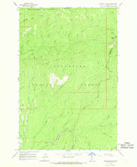
1966 Map of Hemlock Butte
USGS Topo · Published 1968About this map
Clearwater National Forest dominates this mid-1960s survey of north-central Idaho, where the complex drainage systems of Orofino Creek and Lolo Creek carve through the high mountain ridges. The map captures a landscape defined by its extractive history and wilderness management, evidenced by the presence of the Pistol Grip Mine, Red Cloud Mine, and Pioneer Mine. These sites, alongside a Snow Gage near Hemlock Butte, reflect the era's focus on both mineral exploration and water resource monitoring in the Bitterroot foothills.
Find a feature on this map
51 named features on this map. Tap any name to fly to it.
Don’t see what you’re looking for? This feature index may not catch every label — zoom into the map to look around manually.
Map Details
Editions of this 1966 Hemlock Butte Map
2 editions found
Other maps of this area

1923 · Washington Creek
USGS Topo · 1:125,000

1924 · Weippe
USGS Topo · 1:125,000

1938 · Headquarters
USGS Topo · 1:48,000

1944 · Headquarters
USGS Topo · 1:62,500

1956 · Hamilton
USGS Topo · 1:250,000

1959 · Hamilton
USGS Topo · 1:250,000

1960 · Hamilton
USGS Topo · 1:250,000

1964 · Hamilton
USGS Topo · 1:250,000
1965 · Larch Butte
USGS Topo · 1:24,000

1965 · French Mountain
USGS Topo · 1:24,000